Alaminos (1st mill, Niolimon)
Type: Watermill
District: Larnaca
Village: Alaminos
River: Alaminos
Location - Toponym: Niolimo
Cadastral Info: Sheet/Plan 50/57; Plot: 201
-Niolimon-A.-Pitta-&-A.-Theodosiou-thumb.jpg)
Mill Description
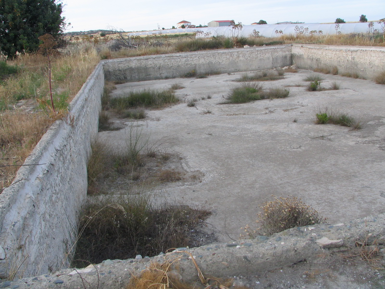
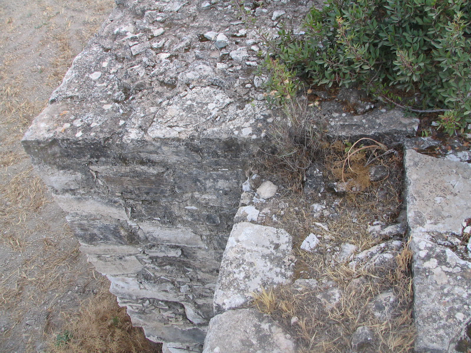
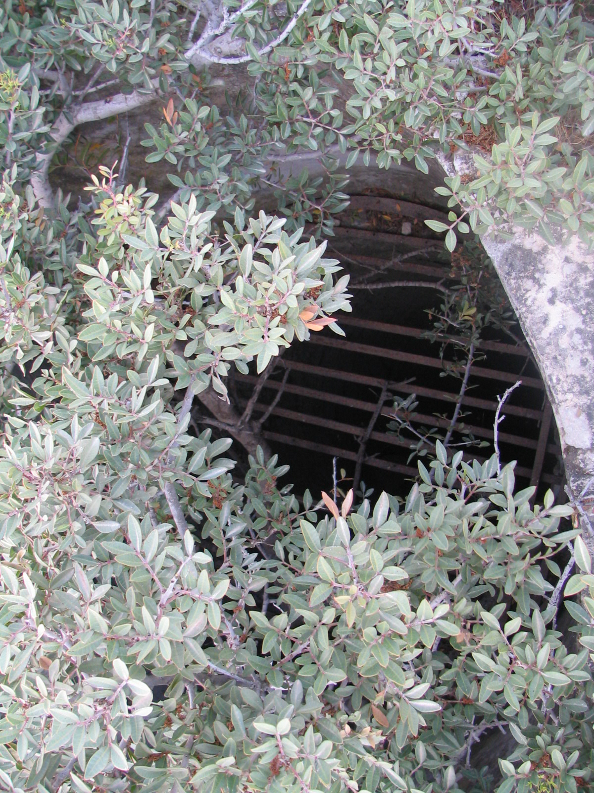
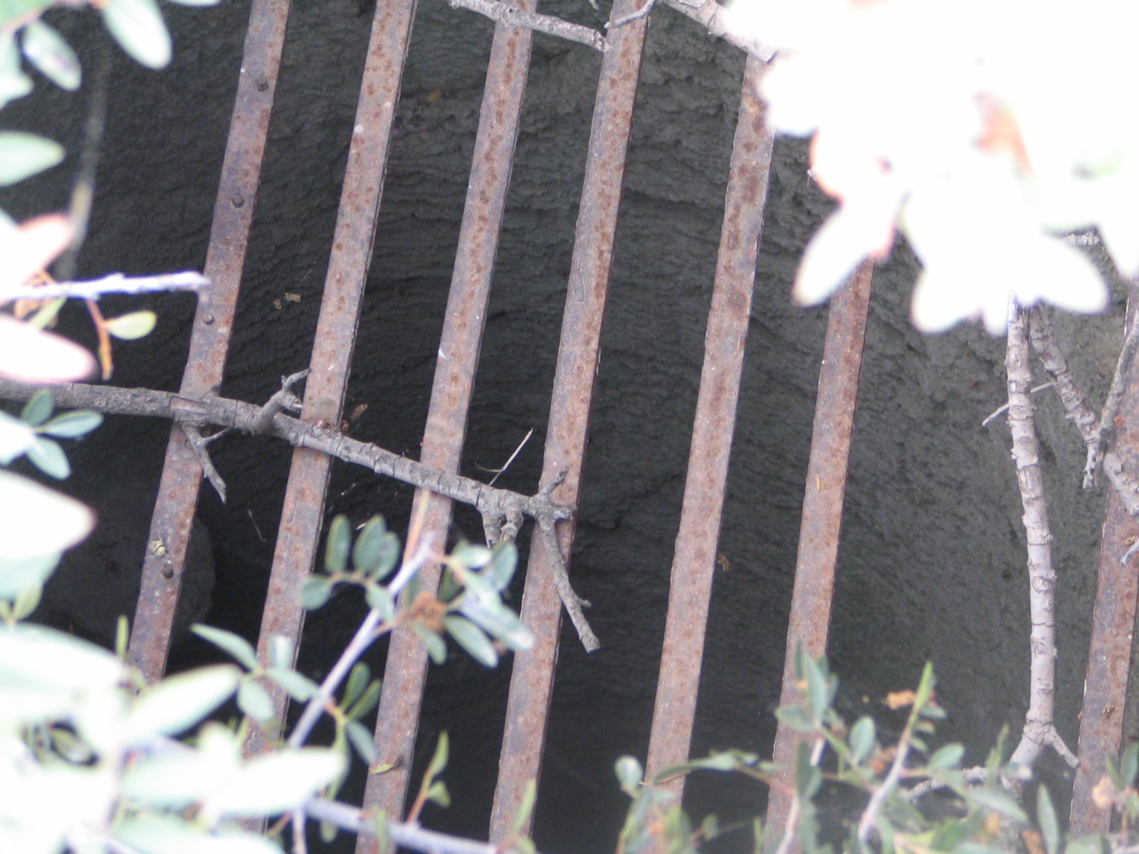
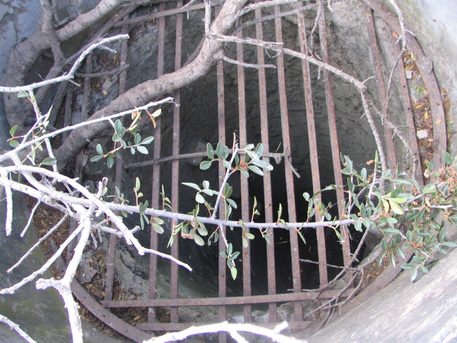
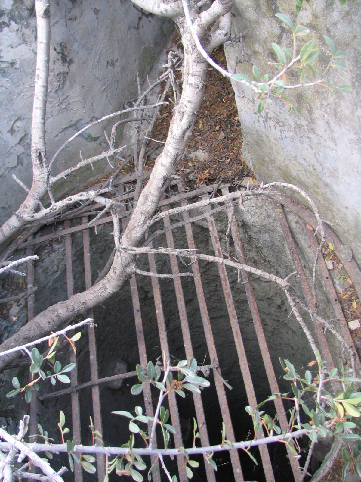
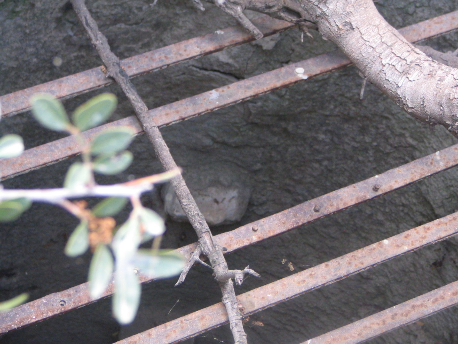
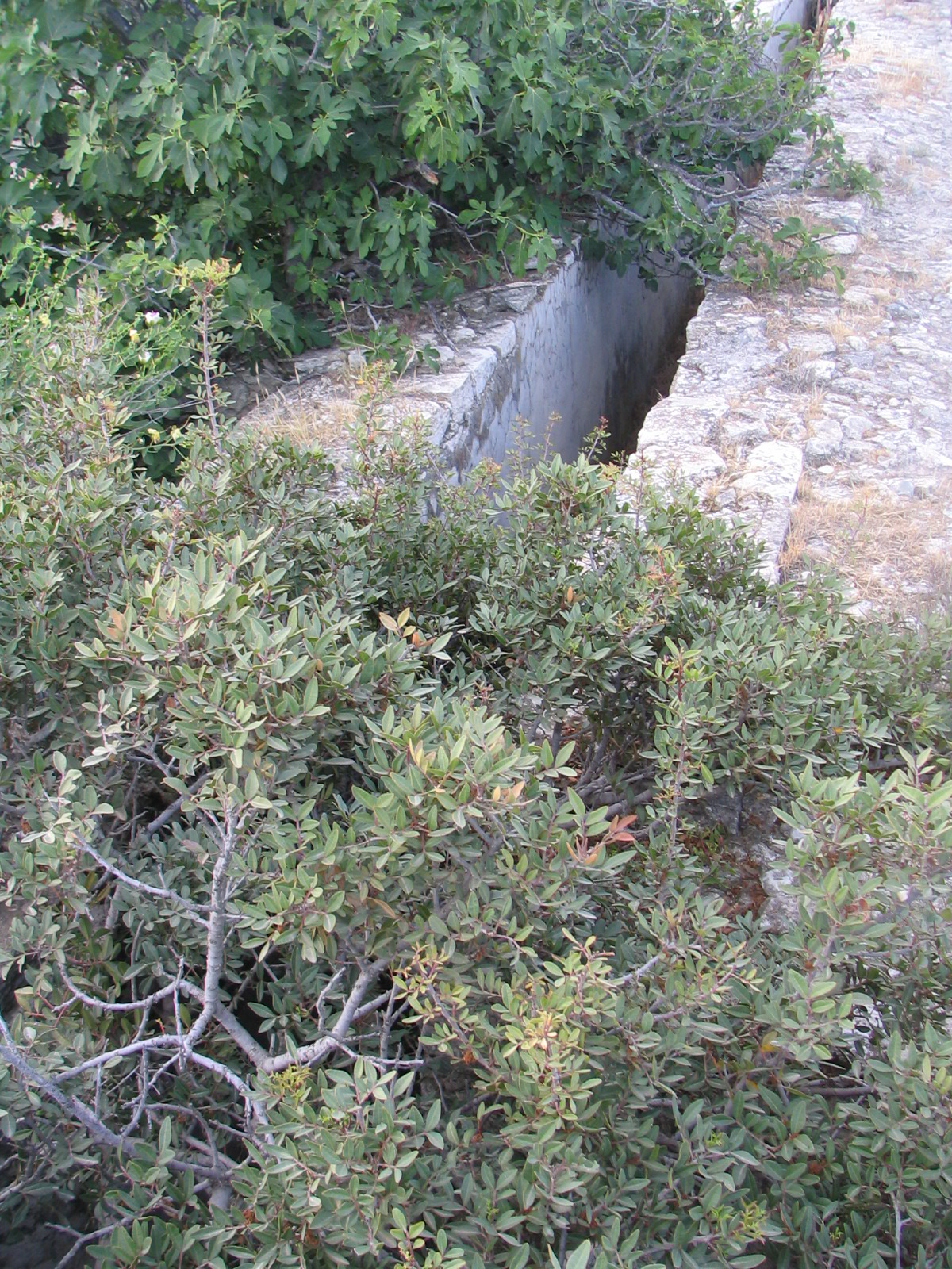
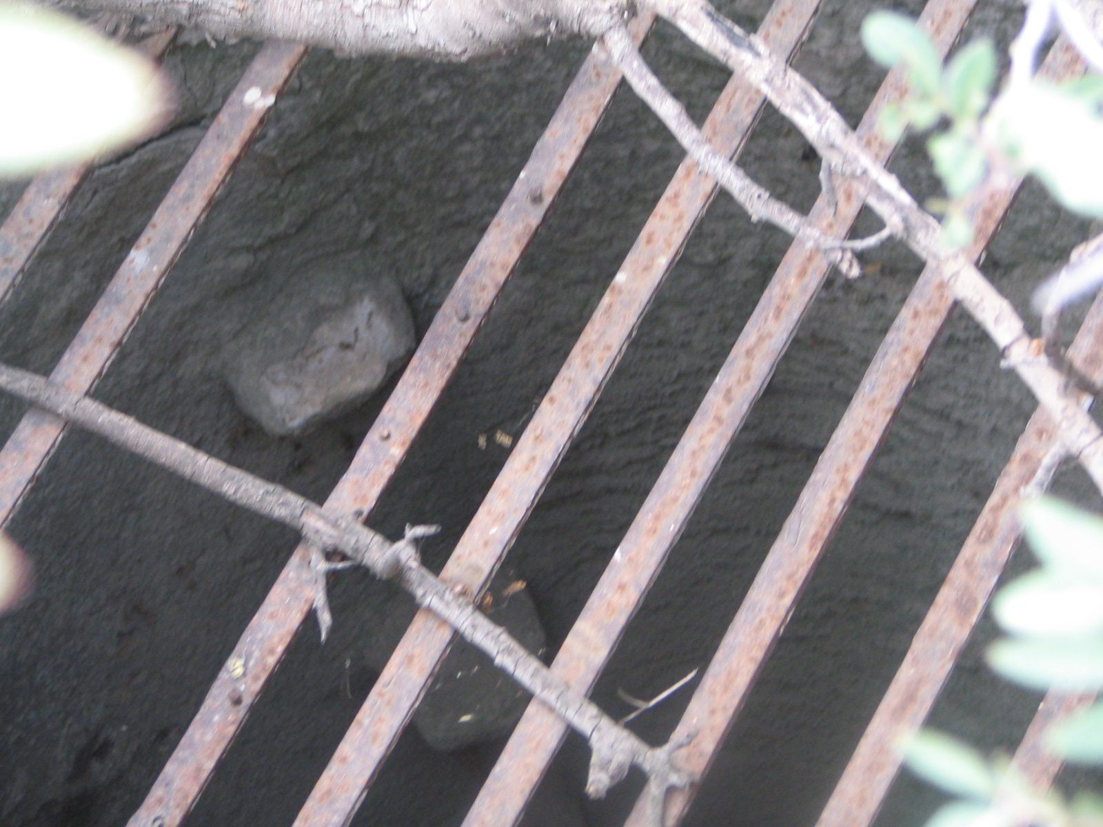
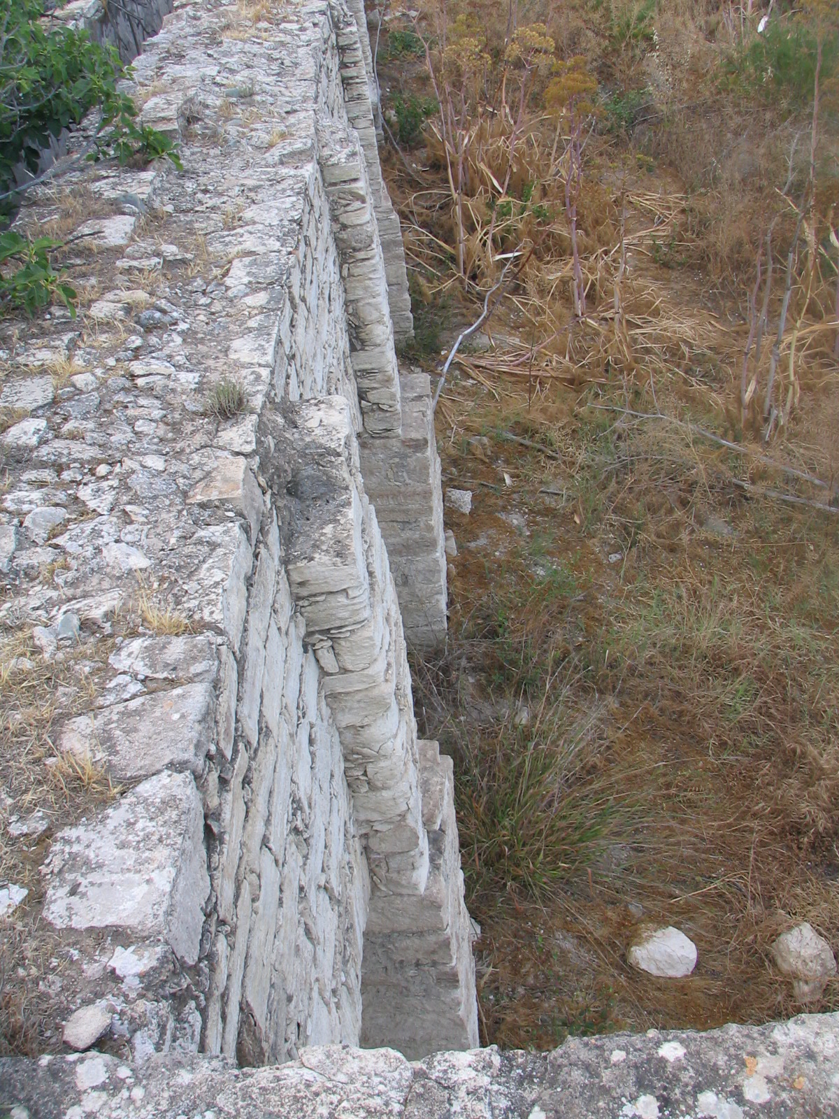
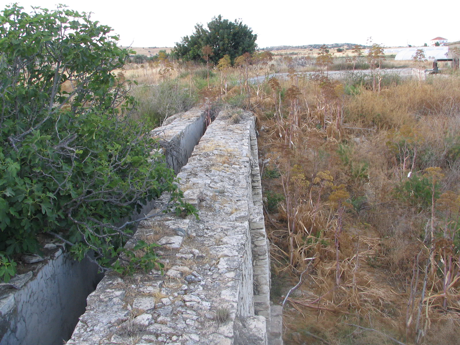
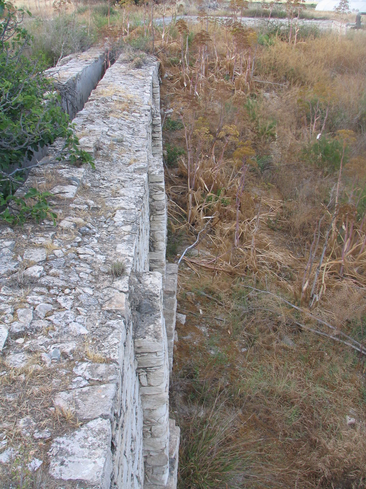
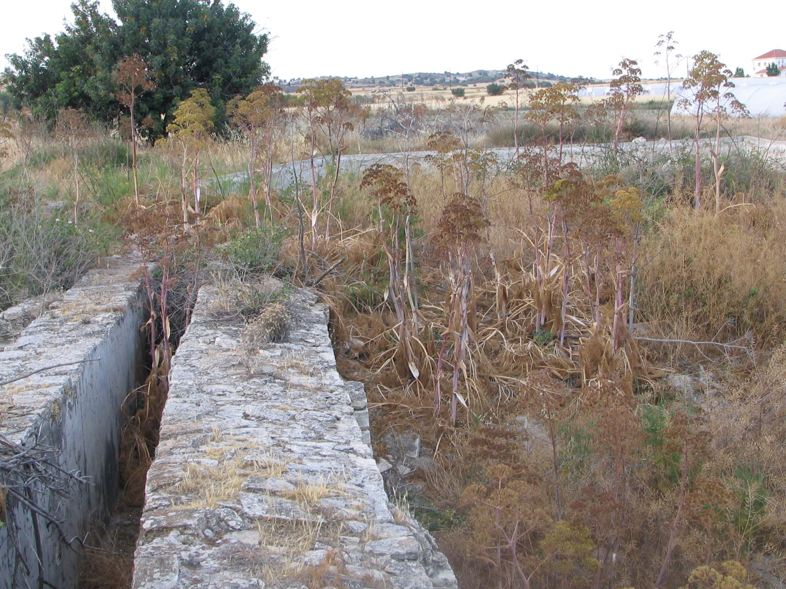
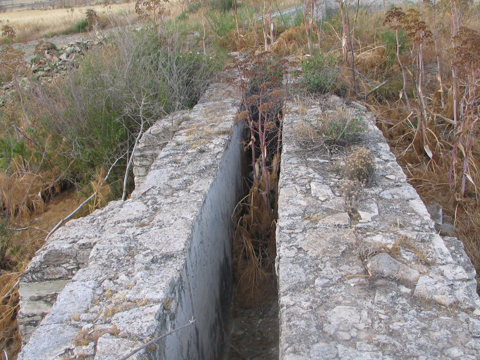
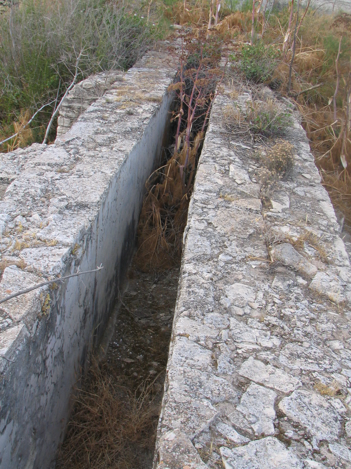
The remains of the Alaminos watermill are located 430m southeast of the Medieval tower-house of Alaminos. The surviving structural remains include the water reservoir, the water channel, the watertower and the opening of the shaft.. Unfortunately, the basement where the waterwheel was located and the ground floor area with the grinding mechanism and the millstones (all components associated with the functioning of the watermill) do not survive. The stonebuilt water-reservoir is larger than any of the other published water-reservoirs in Cyprus, has a rectangular ground-plan and external dimensions of 32.30x16.20m with its long side directed southwest to northeast. Its exterior walls are approximately 0.40 cm thick and there are no external buttresses reinforcing them. The depth of the water-tank is 2.50m, indicating a capacity of 1,308,150ltrs (1,308.15m3) of water. The walls are built with a mix of cut and irregular stones, while their internal surface is coated with laminated hydraulic plaster. The openings that served to supply the mill (as well as for irrigation purposes) are currently not visible, probably due to modern renovations that the tank has undergone. During the latest use-phase of the water reservoir, concrete manholes were constructed and metal tubes of irrigation systems were installed at its southeast side. The water-tank was responsible for storing the water that would set the watermill in motion or use it for irrigation purposes. The channel is preserved on a straight line for more than 23.30m southwest of the water-tank, connecting it directly with the watermill. It is 59cm wide and 1.25m deep, while its walls are in places between 60cm and 1m thick (on the northwest and southeast sides respectively). Internally, the tank is coated with a layer of plaster. Its walls are built partly in the isodomic system with cut stones alternated with a layer of gravel and mortar as adhesive material. On a ground-plan view, the northwest wall seems to be built with a double row of cut stones, filled in the middle with smaller stones, while the southeast wall appears similar but with double fortification. Furthermore, four rectangular buttresses reinforce the standing long walls, while five alternating arches on each side provide additional support to the long channel.The northwest wall appears to be thinner than the southeast; however, the buttresses are larger and have an approximate width of 70-75cm. and a length of 70-80cm, while the thicker southeast wall is supported by thinner buttresses of 17-20cm in width and 60-65cm in length. The arches on both sides are 65cm wide and between 1.80 and 3.30m long, while their surviving height reaches 3m. Their actual height was difficult to determine due to modern backfilling, same as other structural details along the long walls of the channel due to dense vegetation. The channel supplied the watermill with water from the water-tank. The water-tower is 4.35m high, while its reaches 4.15m in length, 3.90m in width and it is roughly rectangular in shape. It is built with roughly cut stones, while smaller irregular stones and gravel were used for the filling. The stones are connected with white and brown mortar. Inside the tower there is usually a tube (penstock) connected to the basement in order to throw the water on the water wheel. The water tower is responsible for dropping the water with force in order to set the water wheel in motion. The pit is located at the top of the water-tower and has a diameter of 3.77m (r=0.60cm). It is circular in shape, while in section it appears as a reverse cone and it is covered with an iron grate. Examining the pit was a difficult task because of a tree that sprouted inside it. The water delivered through the channel ended up into the pit and then through the penstock. On the southwest facade of the water-tower, one can distinguish the protruding elements of a building that used to be attached to the tower with a visible height of 0.95cm, built with the same materials as the tower. This part of the structure needs to be excavated in order to determine the shape and function of the building. Other excavated watermills suggest that it is the spot where the water-wheel and mill stones were installed, responsible for the processing of the grain. The surviving parts of the Alaminos watermill suggest that the structure was either built in two phases or that its was heavily restored in recent times. The older parts (phase 1) comprise the foundations and the lower portion of the tower. The upper part of the tower and the construction of the supporting arches seem to be later (phase 2). Thus, while the foundations seem to date to the early Ottoman period (or even to the Late Middle Ages, between 14th and 16th centuries), the remainder of the complex must have been extensively rebuilt or restored in the late Ottoman period, i.e. in the 18th-19th centuries. One can observe similar building techniques (such as that of phase 2) in other published constructions of the Ottoman era, such as public fountains. In combination with a glazed sherd being identified in the mortar of the restored part of the structure, we could very well argue that the superstructure of the watermill (phase 2) dates to the first half of the 19th century. G. Filippou
Photos
-Niolimon-A.-Pitta-&-A.-Theodosiou.jpg)
Alaminos (1st mill) Niolimon A. Pitta & A. Theodosiou.jpg
-A.-Pitta-&-A.-Theodosiou-(1)---Copy.jpg)
Alaminos (1st mill, Niolimon) A. Pitta & A. Theodosiou (1) - Copy.jpg
-A.-Pitta-&-A.-Theodosiou-(1).jpg)
Alaminos (1st mill, Niolimon) A. Pitta & A. Theodosiou (1).jpg
-A.-Pitta-&-A.-Theodosiou-(10).jpg)
Alaminos (1st mill, Niolimon) A. Pitta & A. Theodosiou (10).jpg
-A.-Pitta-&-A.-Theodosiou-(11).jpg)
Alaminos (1st mill, Niolimon) A. Pitta & A. Theodosiou (11).jpg
-A.-Pitta-&-A.-Theodosiou-(12).jpg)
Alaminos (1st mill, Niolimon) A. Pitta & A. Theodosiou (12).jpg
-A.-Pitta-&-A.-Theodosiou-(13).jpg)
Alaminos (1st mill, Niolimon) A. Pitta & A. Theodosiou (13).jpg
-A.-Pitta-&-A.-Theodosiou-(14).jpg)
Alaminos (1st mill, Niolimon) A. Pitta & A. Theodosiou (14).jpg
-A.-Pitta-&-A.-Theodosiou-(15).jpg)
Alaminos (1st mill, Niolimon) A. Pitta & A. Theodosiou (15).jpg
-A.-Pitta-&-A.-Theodosiou-(16).jpg)
Alaminos (1st mill, Niolimon) A. Pitta & A. Theodosiou (16).jpg
-A.-Pitta-&-A.-Theodosiou-(17).jpg)
Alaminos (1st mill, Niolimon) A. Pitta & A. Theodosiou (17).jpg
-A.-Pitta-&-A.-Theodosiou-(18).jpg)
Alaminos (1st mill, Niolimon) A. Pitta & A. Theodosiou (18).jpg
-A.-Pitta-&-A.-Theodosiou-(19).jpg)
Alaminos (1st mill, Niolimon) A. Pitta & A. Theodosiou (19).jpg
-A.-Pitta-&-A.-Theodosiou-(2).jpg)
Alaminos (1st mill, Niolimon) A. Pitta & A. Theodosiou (2).jpg
-A.-Pitta-&-A.-Theodosiou-(20).jpg)
Alaminos (1st mill, Niolimon) A. Pitta & A. Theodosiou (20).jpg
-A.-Pitta-&-A.-Theodosiou-(21).jpg)
Alaminos (1st mill, Niolimon) A. Pitta & A. Theodosiou (21).jpg
-A.-Pitta-&-A.-Theodosiou-(22).jpg)
Alaminos (1st mill, Niolimon) A. Pitta & A. Theodosiou (22).jpg
-A.-Pitta-&-A.-Theodosiou-(23).jpg)
Alaminos (1st mill, Niolimon) A. Pitta & A. Theodosiou (23).jpg
-A.-Pitta-&-A.-Theodosiou-(24).jpg)
Alaminos (1st mill, Niolimon) A. Pitta & A. Theodosiou (24).jpg
-A.-Pitta-&-A.-Theodosiou-(25).jpg)
Alaminos (1st mill, Niolimon) A. Pitta & A. Theodosiou (25).jpg
-A.-Pitta-&-A.-Theodosiou-(26).jpg)
Alaminos (1st mill, Niolimon) A. Pitta & A. Theodosiou (26).jpg
-A.-Pitta-&-A.-Theodosiou-(27).jpg)
Alaminos (1st mill, Niolimon) A. Pitta & A. Theodosiou (27).jpg
-A.-Pitta-&-A.-Theodosiou-(28).jpg)
Alaminos (1st mill, Niolimon) A. Pitta & A. Theodosiou (28).jpg
-A.-Pitta-&-A.-Theodosiou-(29).jpg)
Alaminos (1st mill, Niolimon) A. Pitta & A. Theodosiou (29).jpg
-A.-Pitta-&-A.-Theodosiou-(3).jpg)
Alaminos (1st mill, Niolimon) A. Pitta & A. Theodosiou (3).jpg
-A.-Pitta-&-A.-Theodosiou-(30).jpg)
Alaminos (1st mill, Niolimon) A. Pitta & A. Theodosiou (30).jpg
-A.-Pitta-&-A.-Theodosiou-(31).jpg)
Alaminos (1st mill, Niolimon) A. Pitta & A. Theodosiou (31).jpg
-A.-Pitta-&-A.-Theodosiou-(32).jpg)
Alaminos (1st mill, Niolimon) A. Pitta & A. Theodosiou (32).jpg
-A.-Pitta-&-A.-Theodosiou-(33).jpg)
Alaminos (1st mill, Niolimon) A. Pitta & A. Theodosiou (33).jpg
-A.-Pitta-&-A.-Theodosiou-(34).jpg)
Alaminos (1st mill, Niolimon) A. Pitta & A. Theodosiou (34).jpg
-A.-Pitta-&-A.-Theodosiou-(35).jpg)
Alaminos (1st mill, Niolimon) A. Pitta & A. Theodosiou (35).jpg
-A.-Pitta-&-A.-Theodosiou-(36).jpg)
Alaminos (1st mill, Niolimon) A. Pitta & A. Theodosiou (36).jpg
-A.-Pitta-&-A.-Theodosiou-(37).jpg)
Alaminos (1st mill, Niolimon) A. Pitta & A. Theodosiou (37).jpg
-A.-Pitta-&-A.-Theodosiou-(38).jpg)
Alaminos (1st mill, Niolimon) A. Pitta & A. Theodosiou (38).jpg
-A.-Pitta-&-A.-Theodosiou-(39).jpg)
Alaminos (1st mill, Niolimon) A. Pitta & A. Theodosiou (39).jpg
-A.-Pitta-&-A.-Theodosiou-(4).jpg)
Alaminos (1st mill, Niolimon) A. Pitta & A. Theodosiou (4).jpg
-A.-Pitta-&-A.-Theodosiou-(5).jpg)
Alaminos (1st mill, Niolimon) A. Pitta & A. Theodosiou (5).jpg
-A.-Pitta-&-A.-Theodosiou-(6).jpg)
Alaminos (1st mill, Niolimon) A. Pitta & A. Theodosiou (6).jpg
-A.-Pitta-&-A.-Theodosiou-(7).jpg)
Alaminos (1st mill, Niolimon) A. Pitta & A. Theodosiou (7).jpg
-A.-Pitta-&-A.-Theodosiou-(8).jpg)
Alaminos (1st mill, Niolimon) A. Pitta & A. Theodosiou (8).jpg
-A.-Pitta-&-A.-Theodosiou-(9).jpg)
Alaminos (1st mill, Niolimon) A. Pitta & A. Theodosiou (9).jpg
brussels may 2005 040.jpg
brussels may 2005 041.jpg
brussels may 2005 043.jpg
brussels may 2005 044.jpg
brussels may 2005 045.jpg
brussels may 2005 046.jpg
brussels may 2005 047.jpg
brussels may 2005 049.jpg
brussels may 2005 050.jpg
brussels may 2005 051.jpg
brussels may 2005 052.jpg
brussels may 2005 053.jpg
brussels may 2005 054.jpg
brussels may 2005 055.jpg
brussels may 2005 056.jpg
brussels may 2005 057.jpg
brussels may 2005 058.jpg
brussels may 2005 059.jpg
brussels may 2005 060.jpg