Pano Koutrafas (tou Memmeti/Mehmeti)
Type: Watermill
District: Nicosia
Village: Koutrafas
River: Tis Elias
Location - Toponym: Dere
Cadastral Info: Sheet/Plan: 28/13; Plot: 71
-thumb.jpg)
Mill Description
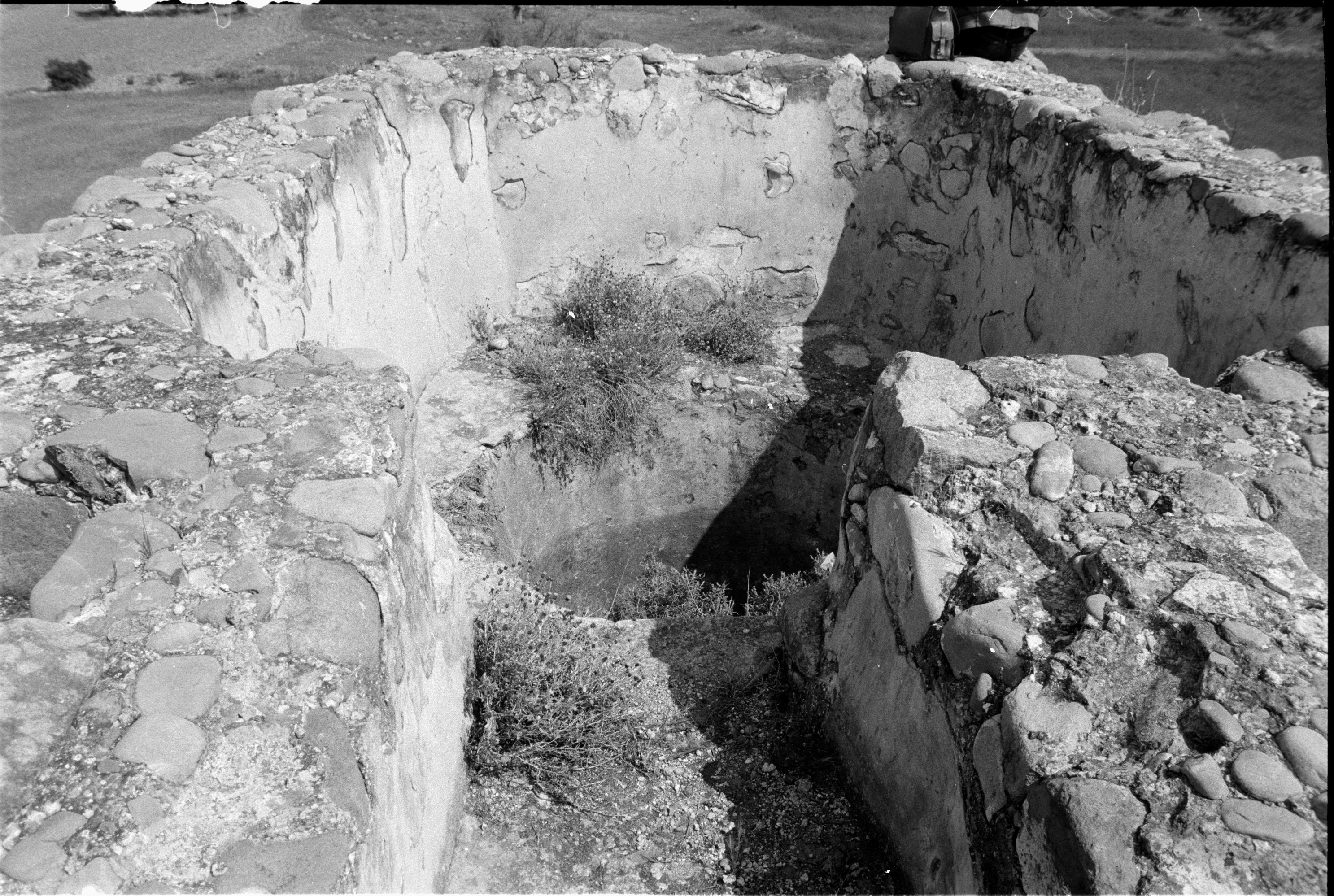
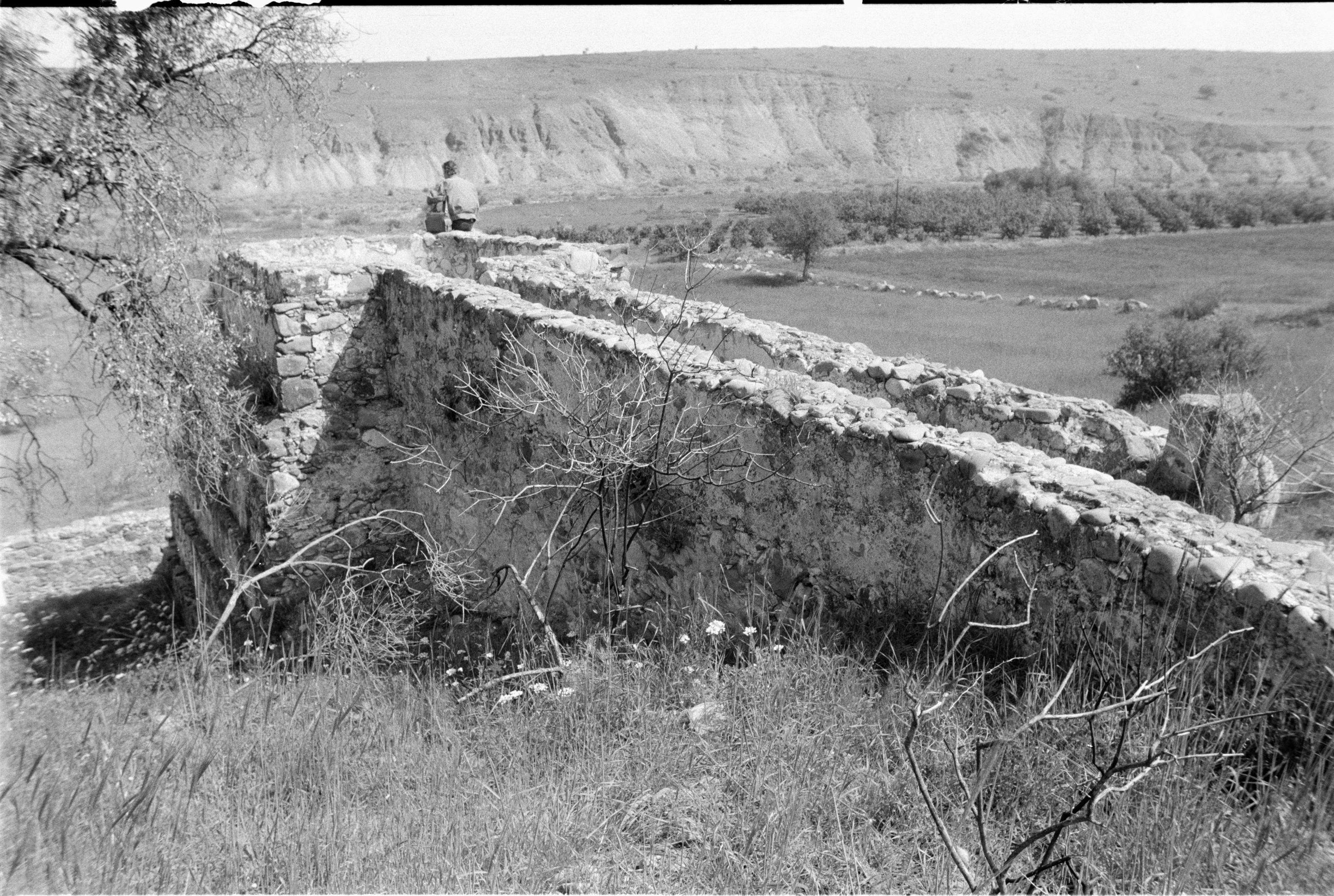
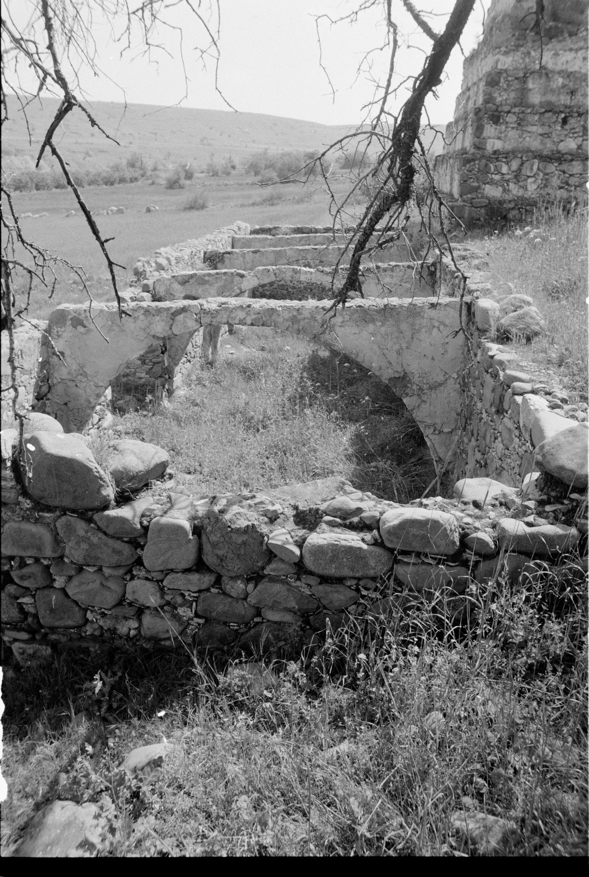
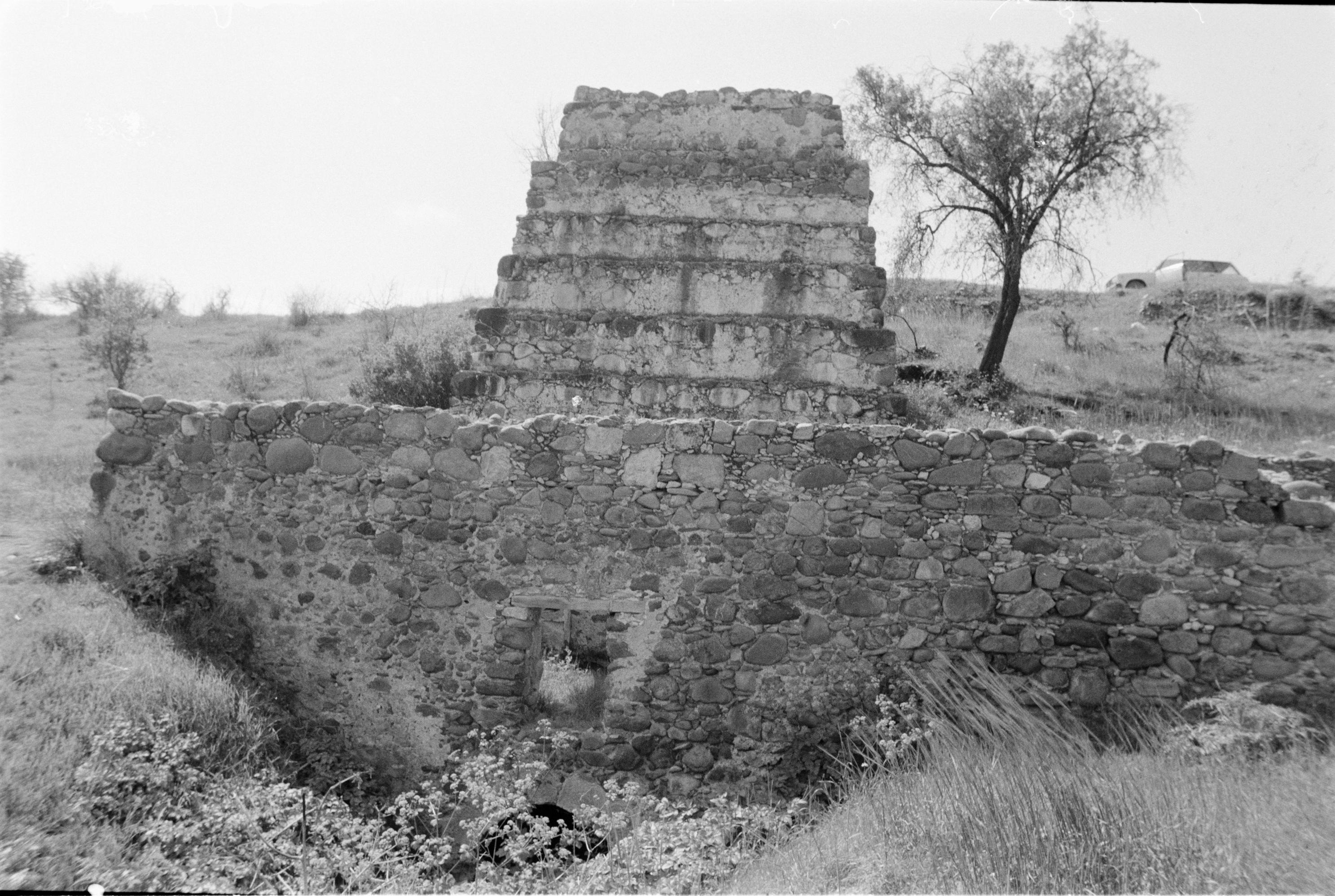
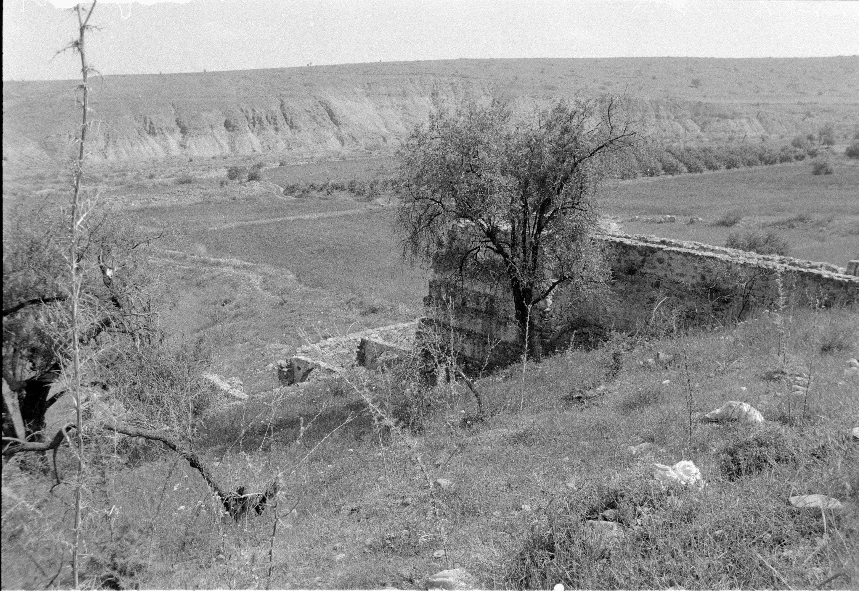
This substantial water mill is located close to the site of a mosque in the abandoned and demolished village of Pano Koutraphas. It is reasonably intact, with a five-tiered penstock and a substantial millroom. The aqueduct bringing water to the top of the penstock is 11m long and 1.55m wide. It has an overflow on its eastern side operated by sluice gates in the main channel and the opening for the overflow. The top of the penstock is 4.25 x 3.65 m, with a shaft 1.75 m in diameter and 5.7 m deep. The turbine does not survive, but there is a well-formed arch at the opening to the turbine room. The turbine room and mill room measure 16.3 x 4.9 m. In the mill room are broken millstones 1.30 m in diameter and a basin lined with plaster. There are niches in its southern wall, a door aperture on the northern side, and a window above the water outlet with a timber lintel. The mill is an ancient monument/schedule B. Is a private Greek-Cypriot property. Recorded by Ian Evans, 2003. Troodos Archaeological and Environmental Survey Project. (TAESP Volume 1: 268; Volume 2: 247–248)
Photos
.jpg)
Koutraphas The Photographic Archive of the Cyprus Department of Antiquities (1).jpg
.png)
Koutraphas The Photographic Archive of the Cyprus Department of Antiquities (1).png
.jpg)
Koutraphas The Photographic Archive of the Cyprus Department of Antiquities (2).jpg
(1).jpg)
Koutraphas The Photographic Archive of the Cyprus Department of Antiquities (3)(1).jpg
.jpg)
Koutraphas The Photographic Archive of the Cyprus Department of Antiquities (3).jpg
(1).jpg)
Koutraphas The Photographic Archive of the Cyprus Department of Antiquities (4)(1).jpg
.jpg)
Koutraphas The Photographic Archive of the Cyprus Department of Antiquities (4).jpg
.jpg)
Koutraphas The Photographic Archive of the Cyprus Department of Antiquities (5).jpg
.jpg)
Koutraphas The Photographic Archive of the Cyprus Department of Antiquities (6).jpg
J65296-P.Koutrafas-Mylos tou Memmeti.jpg
J65297-P.Koutrafas-Neromylos Memmeti.jpg
J65298-Pano Koutrafas-Neromylos.jpg
J65299-P.Koutrafas-Neromylos memmeti.jpg